Drone Survey Company
Commercial Drone Survey
Roofs, elevations, plant and hard to reach structures on commercial and managed buildings, with the paperwork a building manager needs on file.
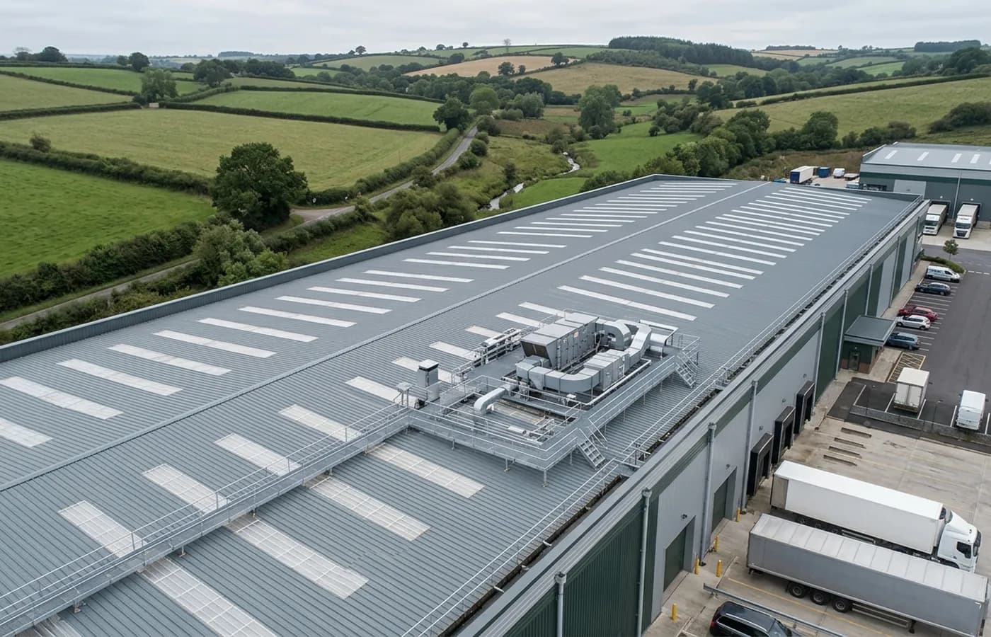
Most commercial roofs get looked at when something has already come through a ceiling. The building has a flat or shallow covering nobody can see from the ground, a set of parapet gutters that silt up quietly, plant sitting on frames that never gets walked around, and a maintenance budget set by whoever last guessed at its condition.
This survey puts the whole of it on record in a morning, without a cherry picker, a scaffold or a roof access permit. It suits facilities teams, managing agents, landlords with a single let unit and owner occupiers who have inherited a building and want to know what they have taken on.
It is also the survey that gets repeated. A building flown to the same pattern twice, a year apart, gives you two sets of images that can be laid side by side, which is a far better basis for a budget than a fresh opinion each time.
What is included
- Every roof slope or roof area, photographed in overview and in detail
- All elevations, including the ones facing a neighbour or a boundary you cannot get to
- Parapet gutters, outlets, downpipes and hoppers
- Roof mounted plant, frames, fixings and the membrane around them
- Rooflights, upstands, flashings and abutments
- Site specific risk assessment and method statement where your building manager wants one
- Coverdrone certificate and the operator registration numbers, sent with the quote
- Written report inside 48 hours with the full resolution imagery
Why a firm rather than a person with a drone
For a commercial instruction the flying is the easy part. What a facilities manager is actually buying is a supplier who can produce a certificate of insurance without a chase, who will not turn up with an aircraft that is not registered, and whose report can be forwarded to a client or a board without needing an explanation attached.
That is why this site leads with registrations and insurance rather than with photographs. A drone image looks the same whoever took it. The difference between two quotes for the same building is almost always in the paperwork and in what happens after the flight.
Repeat surveys and building portfolios
Where a landlord or an agent holds several buildings, the sensible pattern is a set of surveys booked together and flown to the same specification, then repeated on a cycle. Travel gets shared across the group, the images are captured the same way each time, and the reports read as one series rather than a stack of separate opinions.
It also gives you a proper answer to the question that starts most of these enquiries, which is whether a covering has ten years left in it or two. One survey gives you a condition. Two surveys a year apart give you a direction, and direction is what a budget is built on.
What a drone survey does not settle
A survey records what can be seen from the air on the day. It cannot see under a covering, inside a build up, or through standing water, snow or heavy vegetation. It is not a structural engineer's report, a building survey under RICS, or a specification for repair.
Where a finding needs opening up, a core sample, or a specialist opinion, the report says so plainly instead of implying the flight settled it. A firm that never writes that sentence is either flying very simple buildings or overselling what a camera can do.
On the day
How a commercial survey runs
- Step 1
Scope the building
Address, footprint, storey count and what has prompted the survey. On a multi let or a site with several blocks we agree which structures are in and which are not, so the price covers the right thing.
- Step 2
Airspace and ground check
The airspace over the site is checked along with anything nearby that constrains flying. Where the building fronts a public footway or a neighbouring occupied site, we agree how the flight window will be managed before a date is fixed.
- Step 3
Site induction and setup
On a working site that means signing in and speaking to whoever runs the ground. A take off point goes somewhere with a clear view of the aircraft, marked out and coned where the public are close.
- Step 4
Overview then detail
Context passes first so every part of the building is placed, then close work on the roof areas, the gutters, the plant and any specific concern you raised.
- Step 5
Full resolution review and write up
Every frame gone through at full size, findings gathered against the images that show them, and the report sent inside 48 hours.
Behind the work
Kit, cover and qualifications
CAA registered
Registered with the Civil Aviation Authority as an operator, with an Operator ID and a Flyer ID held. Ask for the numbers and you will get them before the visit.
A2 Certificate of Competency
The pilot holds an A2 CofC, the certificate that allows flying closer to uninvolved people than the default. There is no GVC, and this site says so rather than leaving you to guess.
Insured with Coverdrone
Commercial operations are insured with Coverdrone. If your site or your managing agent needs a certificate on file, it goes over with the quote rather than after the flight.
Two aircraft, one pilot
A DJI Mavic 4 Pro with a 100 megapixel Hasselblad camera for detail, and a DJI Mavic 2 Enterprise Advanced with a 640 by 512 radiometric thermal camera. Sam Hembury flies both himself.
Commercial survey
Commercial Drone Survey questions
- Do you need roof access or a permit?
- No. Nobody goes on the roof, so there is no access permit, no harness, no scaffold and no working at height on your risk register. Take off is from ground level somewhere on or beside the site.
- Can you fly while the building is occupied and trading?
- Usually yes. The flight is planned around where people will be, and the take off area is kept clear of the public. Where the only viable flight path runs directly over an occupied area outside your control, we agree a window or a route change with you first rather than flying it anyway.
- Will you provide a RAMS document?
- Yes, site specific, on request at quote stage. It covers the take off area, the flight plan, the ground controls and the conditions under which the flight would be abandoned.
- Can the report go straight to our client or our board?
- That is what it is written for. The findings are in plain terms with the supporting images beside them, and the imagery is yours to use for the purpose it was commissioned for, including passing it on.
Where
Commercial Drone Survey across the South West
Also on this site
See how a job runs
Request a quote with Drone Survey Company
Tell us the address and what you need looking at. Sam Hembury will come back with a fixed price and the next available slot.